How to Score 150+ in prelims,Revision Strategy-By Aishwarya Raj (topper)

Hi friends ,since prelims exam is near, its very important to know the revision strategy for prelims.Who better than Prelims master Aishwarya Raj.

The plan for first 20 days was to broadly run through all subjects once and take one test each day (alternating between UPSC PYQ and Vision/insights full length tests). Last 10 days I had kept only for revising my diary of errors (will explain later how it helped) as well as going through trivial data + map study etc as a (slightly) relaxed mind was way too important to perform well on D-Day.

The first thing that I did was to make a rough timetable of how many days to devote to each subject. It was basis my own evaluation of strong and weak areas (Polity was an issue for me). This is how it was structured:

a


Post that I wrote down a laundry list of things (which were more memory-based and where I used to get confused) which had planned to look up and kept doing them side-by-side. These included :

  1. International groupings with focus on Asia-Pacific ones
  2. Important reports by IMF/WB/WEF/UN/OECD/WIPO
  3. Amendments and imp. articles from Lakshmikanth
  4. Rivers and tributaries (provided here), mountain ranges and soil/forest types of India
  5. Monsoon,El Nino/La Nina phenomena
  6. Important national parks, WLS (in news), biosphere reserves
  7. Environmental organizations (had a Wikipedia tab open always)
  8. CCRT Website + 11th Fine Arts
  9. Government schemes Ministry wise from GKToday compilation
  10. Maps – With focus on Asia and Africa as they are the most confusing
  11. Budget highlights and Eco Survey summary
  12. Major tribes region-wise from MoTA site
  13. Vision monthly magazines’ selected portions

While taking tests, I would do an evaluation right then and jot down the wrong answers/left answers and guesswork ones in the diary. It helped in two ways – one while writing, things stuck to my head as I could concise the text in my own words . Two, revision effort later reduced from a bulky 20 pages to only 2–3 pages for each mock test !

For example, this is how my summary of Vision’s last test looked like:

Page 2:

I also worked on a major blunder I would commit often – of not reading the question properly : whether there is a ‘not’ inserted smartly in between ! Paying attention to details was a major take-away in the final month with rigorous practice and revision.

Mental peace ‘strategy’: As days progressed, tension levels were bound to increase so I ensured doing 15 minutes meditation + reading 1 chapter of Bhagwad Gita daily and a short evening stroll in the nearby park. Some chatting up with close family and friends was also of great help, as social media was anyways de-activated during that time 🙂 . Rarely compromised on the 7–8 hours of sleep (of course some-days sleep is hard to get ) .

In all, things worked out pretty well on 7th August last year. In first go I could do 48 questions in 50 minutes and kept circling the ones for later where I had the slightest of doubt. In second go, attempted 38 where I had some idea and was down to last two options. Finally , last round was a leap of faith with 8 questions which one built intuitively after practice. Expecting around 150 finally.

PS: Please do not have any preconceived notions about the toughness of paper or the number of questions you have to attempt. If paper is very difficult, that holds true for all and you don’t want to attempt hastily all questions. Be wise.

Keep up the momentum with sincerity for now but don’t be too harsh on yourself. It will all work out well in the end ! Good luck.

EDIT: My marks same as estimated :


PS:you can follow Mr. Aishwarya on Quora on following linkAishwarya Raj,He is active on instagram also as Aishwarya Raj.

Faq about IFS/IFoS Exam

I get numerous request about exam process and process thereof, regarding medical test/fitness eligibility.Which Subjects to choose, I Have given answers to some of the common questions here.If you have any more doubts , then shout out.

For questions on which optionals to choose for examination ,Please find answer here

Which optional to choose for forest service

  1. How much is the total and in hand salary of Indian Forest Service officer during the LBSNAA training and after becoming a DFO as per after 7th Pay commission?

2. How should I prepare for the English paper of IFS (Indian Forest Service)?

3.Do IFS (Indian Forest Service) probationers always visit European countries during    their training, or does it vary by batches?

What does the office of a District Forest officer look like?

5.Did anyone regret after getting into the Indian Forest Service that you couldn’t get into IAS? How is your work-life balance compared to IAS?


.


Initial Training at IGNFA

Hi Friends,

Its been about a month , when training started.Precisely Professional course started on 13th Dec 2016.

Indian Forest Service Probationers are trained at Indira Gandhi National Forest Academy situated in dehradun for 16 and a half months.This time batch was formally welecomed by Hon’ble Minister Shri Anil Madhav Dave.

Initially , Daily schedule includes

  1. Morning PT from 6:45 to 7:30 am.
  2. Then,from 9 am to 1 am classes on various topics like overview of forestry, soil science,geology etc are held.
  3. after 2 pm generally there is some local visit to WII (wildlife institute of India) or any nearby plantation or interaction with fellow probationers from other service is arranged.
  4. Finally day officially ends by playing games regularly.

Would share some pics of sports events, cultural evenings soon. Btw we had weapons training also.

Vipul Pandey

IFS(P) 2016-18


Introduction to petrofabrics

Petrofabrics is the study of deformation features in rocks, usually at the grain scale. The most commonly studied features are fractures(distribution, morphology, and orientation), twinning,pressure solution, and recrystallization fabrics.

Petrofabrics provides information on the following:

How to use it

Structural petrofabric analysis is important in a relatively limited number of special situations. It requires oriented subsurface or surface samples and is performed only by a relatively limited number of specialists, usually at universities.

Cut off for IFS/IFoS Mains

Hi All,

Apologies for delayed post.Since this year’s exam was fact based and bit easy (as said by most aspirants) , I expect IFS cut off to shoot up.Last year cut off for UR was around 120+,

My take is this year cut off, may reach upto 125+, but I suggest anybody having marks >120 (from any key) should start preparing.

Agroforestry-Forestry

Agroforestry is a collective name for land-use systems involving trees combined with crops and/or animals on the same unit of land. It combines
1) Production of multiple outputs with protection of the resource base;
2) Places emphasis on the use of multiple indigenous trees and shrubs;
3) Particularly suitable for low-input conditions and fragile environments;
4) It involves the interplay of socio-cultural values more than in most other land-use systems; and
5) It is structurally and functionally more complex than monoculture.


DEFINITION

1) Agroforestry is any sustainable land-use system that maintains or increases total yields by combining food crops (annuals) with tree crops (perennials) and/or livestock on the same unit of land, either alternately or at the same time, using management practices that suit the social and cultural characteristics of the local people and the economic and eco­logical conditions of the area.

2) Agroforestry is a collective name for a land-use system and technology whereby woody perennials are deliberately used on the same land management unit as agricultural crops and/or animals in some form of spatial arrangement or temporal sequence. In an agroforestry system there are both ecological and economical interactions between the various components.


DIFFERENCE BETWEEN SOCIAL FORESTRY AND AGROFORESTRY

Social forestry is defined as “Forestry outside the conventional forests which primarily aim at providing continuous flow of goods and services for the benefit of people. This definition implies that the production of forest goods for the needs of the local people is Social forestry. Thus, social forestry aims at growing forests of the choice of the local population.
Shah (1985) stated that Conceptually Social forestry deals with poor people to produce goods such as fuel, fodder etc. to meet the needs of the local community particularly underprivileged section.


DIFFERENT TERMINOLOGIES FOR DESCRIBING TREE CULTIVATION IN NON-FOREST AREAS


1) Farm Forestry:
Farm forestry is the name given to programmes which promote commercial tree growing by farmers on their own land. Farm forestry was defined by NCA (1976) as the practice of forestry in all its aspects in and the around the farms or village lands integrated with other farm operations.

2) Extension  Forestry:  It is the practice of forestry in areas devoid of tree growth and other vegetation situated in places away from the conventional forest areas with the object of increasing the area under tree growth.
It includes the following.
a)  Mixed forestry
It is the practice of forestry for raising fodder grass with scattered fodder trees, fruit trees and fuel wood trees on suitable wastelands, panchayat lands and village commons
b)  Shelterbelts
Shelterbelt is defined as a belt of trees and or shrubs maintained for the purpose of shelter from wind, sun, snow drift, etc.
c)  Linear Strip plantations
These are the plantations of fast growing species on linear strips of land.

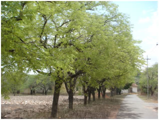
Linear strip plantations

3) Rehabilitation of Degraded forests: The degraded area under forests needs immediate attention for ecological restoration and for meeting the socio economic needs of the communities living in and around such areas.

4) Recreation Forestry: It is the practice of forestry with the object of raising flowering trees and shrubs mainly to serve as recreation forests for the urban and rural population. This type of forestry is also known asAesthetic forestry which is defined as the practice of forestry with the object of developing or maintaining a forest of high scenic value.


TYPES OF AGROFORESTRY SYSTEMS

1. STRUCTURAL BASIS :
A. NATURE OF COMPONENTS

I) AGRISILVICULTURAL SYSTEMS

In this system, agricultural crops are intercropped with tree crops in the interspace between the trees. Under this system agricultural crops can be grown upto two years under protective irrigated condition and under rainfed farming upto four years. The crops can be grown profitably upto the above said period beyond which it is uneconomical to grow grain crops. However fodder crops, shade loving crops and shallow rooted crops can be grown economically. Wider spacing is adopted without sacrificing tree population for easy cultural operation and to get more sunlight to the intercrop. Performance of the tree crops is better in this system when compared to monoculture.


II) SILVOPASTORAL SYSTEMS

The production of woody plants combined with pasture is referred to Silvipasture system. The trees and shrubs may be used primarily to produce fodder for livestock or they may be grown for timber, fuelwood, fruit or to improve the soil.
This system is classified in to three categories

a) Protein bank
b) Livefence of fodder trees and hedges
c) Trees and shrubs  on pasture

4
3

a) Protein bank:
In this Silvipastoral system, various multipurpose trees (protein rich trees) are planted in or around farmlands and range lands for cut and carry fodder production to meet the feed requirement of livestock during the fodder deficit period in winter.
Example: Acacia nilotica, Albizia lebbeck, Azadirachta indica, Leucaena leucocephala, Gliricidia sepium, Sesbania grandiflora

b) Livefence of fodder trees and hedges:
In this system, various fodder trees and hedges are planted as live fence to protect the property from stray animals or other biotic influences.
Example: Gliricidia sepium, Sesbania grandiflora, Erythrina sp, Acacia sp.

c) Trees and shrubs on pasture:
In this system, various tree and shrub species are scattered irregularly or arranged according to some systemic pattern to supplement forage production.
Example: Acacia nilotica, Acacia leucophloea ,Tamarindus indica, Azadirachta indica.


III) AGROSILVOPASTORAL SYSTEMS

The production of woody perennials combined with annuals and pastures is referred Agrisilvopastural system.
This system is grouped into two categories.

5

a) Home gardens
b) Woody hedgerows for browse, mulch, green manure and soil conservation

a) Home gardens

This system is found extensively in high rainfall areas in tropical South and   South east Asia. This practice finds expression in the states of Kerala and Tamil Nadu with humid tropical climates where coconut is the main crop. Many species of trees, bushes , vegetables and other herbaceous plants are grown in dense and in random or spatial and temporal arrangements. Most home gardens also support a variety of animals. Fodder grass and legumes are also grown to meet the fodder requirement of cattle. In India, every homestead has around 0.20 to 0.50 ha land for personal production.

Home gardens represent land use systems involving deliberate management of multipurpose trees and shrubs in intimate association with annual and perennial agricultural crops  and livestock within the compounds of individual houses. The whole tree- crop- animal units are being intensively managed by family labour. Home gardens can also be called as Multitier system orMultitier cropping.

Home gardens are highly productive, sustainable and very practicable. Food production is primary function of most home gardens.

Structure of Home Gardens:

Home gardens are characterized by high species diversity and usually 3-4 vertical canopy strata. The layered configuration and compatible species admixture are the most conspicuous characteristics of all home gardens. Generally all home gardens consist of an herbaceous layer near the ground, a tree layer at the upper levels and an intermediate layer. The lower layer can be partitioned into two, the lowermost being at less than 1.0m in height, dominated by different vegetables and the second layer of 1.0 -3.0/m height comprising food crops such as banana, papaya and so on. The upper tree layer can also be divided into two, consisting of emergent , full grown timber and fruit trees occupying the upper most layer of 25m height and medium size trees of 10-20m occupying the next lower layer. The intermediate layer of 5-10m height is dominated by various fruit trees.

Choice of species:
a) Woody species: Anacardium occidentale,Artocarpus heterophyllus, Citrus spp, Psiduim guajava, Mangifera indica, Azadirachta indica, Cocus nucifera,
b) Herbaceous species: Bhendi, Onion, cabbage, Pumpkin, Sweet potato, Banana, Beans, etc.

b) Woody Hedgerows:
In this system various woody hedges, especially fast growing and coppicing fodder shrubs and trees are planted for the purpose of browse, mulch, green manure, soil conservation etc. The following species viz., Erythrina sp, Leucaena luecocephala, Sesbania grandiflora  are generally used.

IV) OTHER SYSTEMS

a) Apiculture with trees: In this system various honey (nector) producing trees frequently visited by honeybees are planted on the boundary of the agricultural  fields

b) Aquaforestry: In this system various trees and shrubs preferred by fish are planted on the boundary and around fish ponds. Tree leaves are used as feed for fish. The main role of this system is fish production and bund stabilization around fish ponds

c) Mixed wood lots: In this system, special location specific MultiPurpose Trees   ( MPTs) are grown mixed or separately planted for various purposes such as wood, fodder, soil conservation , soil reclamation etc.


B. ARRANGEMENT OF COMPONENTS
I) Spatial arrangement
II) Temporal arrangement

) Spatial Arrangement: Spatial arrangement of plants in an agroforestry  mixture may result in dense mixed stands ( as in home gardens) or in sparse  mixed stands ( as in most systems of trees in pastures).

b) Temporal Arrangement: Temporal arrangements of plants in Agroforestry may also take various forms. An extreme example is the conventional shifting cultivation cycles involving 2-4 years of cropping and more than 15 years of fallow cycle, when a selected woody species or mixtures of species may be planted. Similarly, some silvipastoral systems may involve grass leys in rotation with some species of grass remaining on the land for several years. These temporal arrangement of components in agroforestry are termed coincident, concomitant, overlapping, separate and interpolated.


2. FUNCTIONAL BASIS


All agroforestry systems have two functions.
A) Productive functions,
B) Protective functions

A) Productive functions


The Productive functions are:
I) Food
II) Fodder
III) Fuel wood
IV) Cloths
V) Shelter
VI) NTFPs

B) Protective functions


The Protective functions are:
i) Wind breaks
II) Shelterbelts
III) Soil conservation
IV) Soil improvement


3. SOCIO-ECONOMIC CLASSIFICATION


Based on socioeconomic criteria as scale of production and level of technology input and management, agroforestry systems have been grouped in to three categories.

A) Commercial   Agroforestry systems
B) Intermediate Agroforestry systems
C) Subsistence  Agroforestry systems

A) Commercial AF systems:
The term commercial is used whenever the scale of the production of the output is the  major aim of the system.
Examples:
a)
Commercial production of plantation crops such as rubber, oilpalm, and coconut  with permanent underplanting of  food crops, pastures
b) Commercial production shade tolerating plantation crops such as coffee, tea and cocoa under overstorey of shade trees

B) Intermediate AF systems:
Intermediate systems are those between commercial and subsistence scale of production and management.
 Examples:
Production of perennial cash crops and subsistence food crops undertaken on farms wherein the cash crops fulfill the cash  needs and the food crops meet the family‘s food needs.

C) Subsistence AF systems:
Subsistence AF systems are those wherein the use of land is directed towards satisfying basic needs and is managed mostly by the owner and his family.


4.ECOLOGICAL CLASSIFICATION

A) Humid / sub humid
B) Semiarid / arid
C) Highlands

A) Agroforestry systems in Humid / Subhumid lowlandsExamples:
Homegardens, Trees on rangelands and pastures, improved fallow in shifting cultivation and Multipurpose woodlots.

B) Agroforestry systems in Semiarid and arid landsExamples:
Various forms of silvopastoral systems, wind breaks and shelterbelts.

C) Agroforestry systems in Tropical High landsExamples:
Production systems involving plantation crops such as coffee, tea, use of woody perennials in soil conservation and improved fallow.


BENEFITS OF AGROFORESTRY SYSTEM

 A)  Environmental benefits
i)    Reduction of pressure on natural forests.
ii    More efficient recycling of nutrients by deep rooted trees on the site
iii)  Better protection of ecological systems
iv)  Reduction of surface run-off, nutrient leaching and soil erosion through impeding effect of tree roots and stems on these processes
v)   Improvement of microclimate, such as lowering of soil surface temperature and reduction of evaporation of soil moisture through a combination of mulching and shading
vi)  Increment in soil nutrients through addition and decomposition of litterfall.
vii) Improvement of soil structure through the constant addition of organic matter from decomposed litter.

B) Economic benefits

i)          Increment in an outputs of food, fuel wood , fodder, fertiliser and timber;
ii)         Reduction in incidence of total crop failure, which is common to single cropping or monoculture systems
iii)        Increase in levels of farm income due to improved and sustained productivity

C) Social benefits

i)          Improvement in rural living standards from sustained employ­ment and higher income
ii)         Improvement in nutrition and health due to increased quality and diversity of food outputs
iii)       Stabilization and improvement of communities through elimination of the need to shift sites of farm

Source -http://agritech.tnau.ac.in/forestry/agroforestry_index.html

Aerial photography -Foresty/Geology

This topic is common in both forestry and geology and important in both.


  • Aerial Photographs (APs) is a perspective projection of earth’s surface while map is its orthographical projection.
  • AP provides images on a photographic film or paper
  • It shows actual images of objects found on earth and ground features
  • Scale of APs vary from place to place even in the same photograph
  • It records all ground objects whether wanted or not for aspecific purpose. So, unwanted details may obstruct to perceive wanted details
  • It can be subjected to rough or quick study which isreceived on ground
  • It provides 3-Dimensional view of the earth’s surface andobjects on it.
  • It facilitates selection of best locations for many purposessuch as road alignment, bridge and dome sites, forest destruction, etc
  • It has to be studied and interpreted under a stereoscopicand/or with certain aids and instruments

Classification

APs can be classified on the basis of :

  1. Film used
  2. Device use
  3. Scale of photograph
  4. Position of optical axis of camera

Time of photography

Ideal time of photography: 9-11 am & 1-2 pm. Other times are not suitable to maintain accuracy because morningSun is not risen well and shadow of hills and trees are longer and Noon: Very high sun increase chance of hot spot so image be blunt. Condition of the weather cloudy as well

Season of photography

October to February

  • Coniferous forest – October-November
  • Mixed forest – December -February
  • Sal tropical forest – Mid march –mid April
  • Tropical evergreen forest – January-February
  1. Location of forests, their distribution and area: A map of forests in general and by functional classificationin particular is required. In the productive forests, maps of forest areas by forest types, by productivity of sites and bymaturity classes, etc are necessary to assess the yield of forests.
  2. Growing stock in the production forests:Inventory of trees by species and by diameter classes is required. This aids in estimating volume by location so that management plans could be drawn or industrial plan may be prepared.
  3. Information about various factors affecting production: The information on site, diameter and height, increment, age, timber quality and also about areas where new forests could be raised is necessary.

1. Vertical Aerial Photograph

A vertical photograph is one which has been taken with optical axis of camera approximately perpendicular to the horizontal plane. A deviation up to 4° is acceptable. This gives the map of the earth detail somehow in same scale.

2. Oblique Aerial Photographs

An oblique photographis one which has been taken with the optical axis of the camera intentionally tilted from perpendicular position obliquely. The degree of tiltfrom the perpendicular further classifies oblique photographs into high oblique photograph and low oblique photograph. A high oblique photograph is one which is taken with the optical axis of the camera making an angle >30° with the vertical axis and which shows the apparent horizon on the photograph.

The scale of photography is the ratio of distance on a photograph to its corresponding distance on the ground. It is either expressed as ratio or representative fraction.

Types of Scale

  1. Small scale (1:40000 to 1:70000) used for broad land classification
  2. Medium scale (1:20000 to 1:400000), used for preparation of forest inventory
  3. Large scale (1: 5000 to 1:20000); used for preparing working plan, road alignment


  • In order to prepare the aerial photograph, a flight line is marked on a map called flight map
  • These are straight and continuous lines from one end to another and are laid parallel to each other in such way that while the entire is area is covered
  • There is 30% overlap in between photographs taken from two consecutive flight lines
  • The direction of lines is decided on the basis of requirement of navigation, photo interpretation, shape and size area photographed
  • The lateral of side laps depends up on the distance between two consecutive flight lines and as already stated they are arranged to have a side 30% but it should not be less than 15%.

Deviations in Flight line

1. Drift: if is the horizontal displacement of aircraft due to wind from its original determined course or planned flightwhile photographer continues to make exposures oriented to the predetermined flight line.

2. Crab: it is the continuous caused by the failure to orient the camera so that axis perpendicular to the long dimension of the film is parallel to the track of the airplane. This is indicated in vertical photography by sides of photographs not being parallel to the principal point baseline

3. Drift and tilt: should not be exceed 10% of the width, otherwise it may affect in the result in stereoscopic interpretation.

4. Tilt: is angle between the optical axis of the camera and plumb line for given photograph. Tilt is caused by deviation of the optical axis from the perpendicular. It should not be exceed 2° in normal condition but in extreme it may acceptable up to 5°.

It is defined as an act of examining photographic images and judging their significance. This includes interpreter and photograph

1. Interpreter:

  • Good vision
  • Well-trained for photo interpreter
  • Sufficient experience of doing the work successfully
  • Good knowledge of locality and type of forest present there
  • Good power of concentration and great deal of patience

2. Photographs: Photographs should be of high quality and free from defects

Elements of aerial photo interpretation

It is done on the basis of following pictorial elements:

  1. Tone: Tone refers to the relative brightness of objects on photographs. On B/W photographs, tone varies from white (1) to black (10) with various shade of grey in between. The tone of an object provides more information than any other single element of object recognition. Young stands are lighter compared to mature stands. The phenological changes such leaf fall, new flush of leaves, flowering and fruiting also affect tone of trees’ spps on APs.
  2. Size: The size of an object image depends upon the object’s size, scale of photograph and resolve power of camera. The minimum size of object to be visible on APs should be about 1/20th minimum. A super highway should not be confused with rural road, a small residence with an apparent building, etc.The size of the crowns and their heights often give a good indication for identification of certain species when other pictorial elements, i.e. tone may not differentiate them from other species.
  3. Shape: Shape refers to the general form or outline of individual objects eg. roads, building, rivers, trees, etc.The shape of a tree crown is important in identification of the species. Most conifers and young broadleaved species have an ovate shaped while those of mature broadleaved species are dome shaped crowns (circular).
  4. Texture: Texture is the degree of coarseness or smoothness of an image and is dependent on shape, size, tone, scale, sun elevation as well as reflection properties of the objects. In forestry, smooth texture is often associated with young trees and coarser texture with older trees. It is more useful in interpretation of larger groups of objects like tree stands. Branching habit and age of trees decide the texture of trees.
  5. Location or site: As different species are found in different places under the influence of locality factors, location or site is helpful in identifying species, egridges and slopes are covered by coniferous in hills whereas, nallahand valleys covered by broadleaved species. In plain, only certain species are found while in hills, other certain species are found, eg. Fir, spruce, chirpineand deodar occur in certain elevation and on certain aspects.
  6. Association: Association refers to occurrence of certain features in relation to others. Some tree species are so closely associated that each helps to confirm the presence of others. Certain tree species can be identified by recognition of other species, which grow together, eg. Khairand Sisooare associated with fresh alluvial deposits in riverainareas.
  7. Shadow: Shadow of objects falling on ground gives an indication of objects. It depends on the time of photography and direction of flight. Shadow of the trees falling on ground help in identification of species as they give an indication of the shape of the crown. Wind, however, affects the shadows and makes identification difficult
  8. Pattern: Pattern refers to the spatial arrangement of objects like orchard, plantation, etc is a characteristics of man made objects. Those can be easily separated from natural objects such as natural forest, ridges, drainage, which have random pattern.It describes the regularity and characteristics arrangement of different shades of tone or texture in a photograph.

Trilobites-geology

Trilobites are one of the important topic in paleontology and there is one complete site dedicated to them.I am sharing here , relevant information from exam point of view ,even if somebody want more information,then kindly visit the site.

Trilobites are remarkable, hard-shelled, segmented creatures that existed over520 million years ago in the Earth’s ancient seas. They went extinct before dinosaurs even came into existence, and are one of the key signature creatures of the Paleozoic Era, the first era to exhibit a proliferation of the complex life-formsthat established the foundation of life as it is today. Although dinosaurs are the most well-known fossil animals, trilobites are also a favorite among those familiar with Paleontology (the study of the development of life on Earth), and are found in the rocks of all continents.

fossil (left) and reconstruction (right) of Flexicalymene meekiANCIENT ARTHROPODS
Trilobites were among the early arthropods, a phylum of hard-shelled creatures with multiple body segments and jointed legs(although the legs, antennae and other finer structures of trilobites only rarely are preserved). They constitute an extinct classof arthropods, the Trilobita, made up often orders, over 150 families, about 5,000 genera, and over 20,000 described species. New species of trilobites are unearthed and described every year. This makes trilobites the single most diverse class of extinct organisms, and within the generalized body plan of trilobites there was a great deal of diversity of size and form. The smallest known trilobite species is under a millimeter long, while thelargest include species from 30 to over 70 cm in length (roughly a foot to over two feet long!). With such a diversity of species and sizes, speculations on the ecology of trilobites includes planktonic, swimming, and crawling forms, and we can presume they filled a varied set of trophic (feeding) niches, although perhaps mostly as detritivores, predators, or scavengers. Most trilobites are about an inch long, and part of their appeal is that you can hold and examine an entire fossil animal and turn it about in your hand. Try that with your average dinosaur!


cephalon, thorax, and pygidiumall line drawings ©1999 – 2009 by S. M. Gon III


.
THE TRILOBITE BODY PLAN

Whatever their size, all trilobite fossils have a similar body plan, being made up of three main body parts: a cephalon (head), a segmented thorax, and a pygidium (tail piece) as shown at left. However, the name “trilobite,” which means “three lobed,” is not in reference to those three body parts mentioned above, but to the fact that all trilobites bear a long central axial lobe, flanked on each side by right and leftpleural lobes (pleura = side, rib). These three lobes that run from the cephalon to the pygidium are what give trilobites their name, and are common to all trilobites despite their great diversity of size and form. You can examine the trilobite body plan in more detail using the links on the navigation bar below, or link directly to a page describing trilobite major features.

three lobes: left, right, and middle (axial)

Source -http://www.trilobites.info/trilobite.htm

Ichnofossils-geology

What are ichnofossils?
They are trace fossils: preserved tracks or other signs of the behaviors of animals in the substrate. Ichnofossils can provide some very intriguing insights on the ecology and behavior of an extinct animal such as a trilobite. It is very rare that the animal itself is found in direct association with the ichnofossil it created, but that kind of co-occurrence allows scientists to link ichnofossils with the species that created them.  In fact, in the pre-Cambrian fossil record, there are no trilobites, but there are trace fossils which very closely resemble those made by trilobites, suggesting that before trilobites developed their hard calcite shells, their ancestors were crawling about leaving traces. While there are hundreds of named ichnofossil types, there are three main named categories of ichnofossils associated with trilobites: Rusophycus,Cruziana, and Diplichnites, described below.

Trace Elements-Geology


The Use of Trace Elements in Igneous Petrology


Introduction:

Trace elements are those which occur in very low concentrations in common rocks (usually < 0.1 % by weight). Their concentrations are therefore commonly expressed in parts per million (ppm; 1 ppm = 10-4 weight%). Unlike major elements, trace elements tend to concentrate in fewer minerals, and are therefore more useful in formulating models for magmatic differentiation, and in some cases, in predicting the source of a particular magma. Trace elements most commonly used for the interpretation of the petrogenesis of igneous rocks include: Ni, Cr, Sc, V, Rb, Ba, Sr, Zr, Y, Nb and the rare earth elements (La to Lu). Keep in mind that the concentration of trace elements will vary with the rock type; whereas Ni and Cr show higher concentrations in mafic and ultramafic rocks, Zr and Rb are more concentrated in acidic rocks. Accordingly, some major or minor elements as K and P, which occur in very low concentrations in basalts (approaching trace levels), are just as useful in petrogenetic interpretations as some trace elements (in the case of basalts only, .. of course!).


The incorporation of a trace element in the crystal structure of one or more minerals depends largely on its charge and radius, but also on the electronegativity of this element, and crystal field effects. Accordingly, a trace element will either substitute for a major element in the structure of a crystallizing mineral, or remain in the liquid.


Types of trace elements:

In addition to this simple classification of trace elements into compatibles and incompatibles, trace elements are perhaps better classified on the basis of their geochemical characteristics (which will naturally influence whether the element becomes compatible or incompatible).

1)   Large ion lithophile elements (LILE): These elements are characterized by large ionic radii, and low charges, and will therefore preferentially concentrate in the liquid until a particular phase with large enough sites to accommodate them begins to crystallize. These elements will therefore be largely “incompatible” particularly with respect to mantle phases (Ol, Opx, Cpx, Gt, .. etc). Examples include: K, Rb, Sr and Ba.

2)   High field strength elements (HFSE): These are elements which have large cations, but also large charges, and are also excluded from mantle phases and more concentrated in residual liquids (i.e. they will be more incompatible). These elements are concentrated in accessory phases as sphene, zircon, and apatite. Examples include Zr, Hf, Nb, Ta, Th and U.

3)   Transition elements: Trace elements which are also transition elements are characterized by relatively small ionic radii, and are either bi- or tri-valent. These elements are strongly partitioned in the solid phases that crystallize during the early stages of magmatic evolution, and are therefore “compatible” with mantle phases. Examples include Ni, Co, Cr, and Sc.

4) Rare earth elements (REE): This is a group of elements with atomic numbers between 57 (La) and 72 (Lu) characterized by relatively large ionic radii, and valences of either +2 or +3. They have proven to be very important for petrogenetic interpretations. However, these elements occur in very low concentrations in igneous rocks, and are difficult to analyze for.


Applications of trace elements to Igneous Petrogenesis

1- Testing models of magmatic differentiation using trace elements:

Relies on calculating the concentrations of trace elements remaining in the liquid once a certain amount of a particular mineral fractionates. The method can also be utilized to determine how much partial melting is needed to produce a specific magma from a given rock type. It is therefore invaluable for testing models of partial melting vs. fractional crystallization.


2- Determination of the depth of generation of a primary magma:

Because different trace elements have different chemical characteristics, their concentrations in a magma produced by partial melting of a source rock will depend on the phases occurring in this source rock and the abundance of these phases. For example, elements such as Sr are strongly fractionated in plagioclase feldspars. In the absence of Plag from the source rock, Sr will be incompatible, and will be highly enriched in a magma formed by small degrees of partial melting. If the source rock is Plag – bearing, the magma will be less enriched in Sr (for the same % of partial melting), until Plag melts completely.


As you are aware, primary basalts are produced by partial melting at different depths in the mantle. At shallow depths, the mantle consists of Plag lherzolite, at depths between 40 and 80 km, it consists of spinel lherzolite, whereas at depths > 80 km, it consists of garnet lherzolite. Because Plag, Spinel and garnet concentrate Sr, V + Cr, and heavy rare earth elements (HREE), respectively, magmas produced by small degrees of partial melting at shallow depths will be depleted in Sr, those from intermediate depths will be depleted in V and Cr, whereas those from depths > 80 km will be depleted in HREE. Trace element contents of different types of primary magmas indicate that these can be produced by different degrees of partial melting at different depths in the mantle, as listed in the following Table:


Type of primary magma Depth (km) % melt
Tholeiite 25 – 50 10 – 30
AOB & Basanite 50 – 100 2 – 10
Nephelinite, Kimberlite, and Carbonatite > 75 1 – 2


3- Prediction of the phases fractionating from a magma:

The same rationale presented in (2) above applies for the identification of the phases which have fractionated from a magma undergoing fractional crystallization. Separation of: (a) Plag depletes the remaining melt in Sr and Eu, (b) Ol depletes it in Ni and Co, (c) spinels deplete it in V, Cr and possibly Zn, (d) K-spar in Ba and Rb, … etc.


4- REE and REE diagrams:

REE are very useful for petrogenetic interpretations. Their concentrations in an igneous rock are usually divided by (i.e. normalized against) their concentrations in standard chondrites or N-MORB (normal mid – oceanic ridge basalt) in order to smooth out large differences in concentration between one REE and the other. These normalized values are then plotted on diagrams similar to that shown on Fig. 4a, where the REE are arranged on the X-axis from the lightest element to the heaviest. In the case of an igneous rock series (a group of co-magmatic rocks), the REE concentrations will increase systematically with progressive differentiation as they are largely incompatible (unless we have garnet in the source rock from which the magma formed).


REE diagrams are also useful in identifying which phase or phases fractionate from a magma, following the same rationale presented in (2) and (3) above. In order to identify such phases, it is necessary to know which REE are preferentially incorporated in which phases. REE diagrams are also used to determine the type of basalt (whether AOB or tholeiite).


5- Discriminant diagrams:

Trace elements can also be used to identify the paleotectonic setting of some volcanic rocks (i.e. to determine where they were erupted). In this case, rather than use the absolute concentrations of trace elements (which may have been affected by such post-magmatic processes as weathering, alteration or metamorphism), ratios of relatively immobile trtace elements (as these are least affected by post magmatic processes).